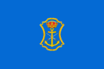
Nerja
 |
 |
Under Muslim rule, its name was Narixa, which means "abundant source" and is the origin of the current name.
Nerja has a long history, evidenced by the primitive paintings found in its famous Nerja caves, discovered in 1959. These caves are now believed to be just one entrance to a linked series of sinkholes stretching many miles into the mountains between Nerja and Granada, and which may yet prove to be one of the most extensive unexplored systems in Europe. Visitors to the caves will be able to view the remains of one of the ancient inhabitants of Nerja.
The Romans built three settlements here, including Detunda, of which now large remains can be seen. The area was later taken over by the Arabs in the early 8th century. Under the Moors, the town was known as Narixa, which means "abundant spring", from which the present name derives.
Its agricultural and silk products are said to have been famed throughout the Muslim world and in the markets of Damascus as early as the 10th century.
The Balcón de Europa, a mirador or viewpoint which gives views across the sea, is in the centre of the old town. Its name is popularly believed to have been coined by King Alfonso XII, who visited the area in 1885 following a disastrous earthquake and was captivated by the scene. Local folklore says that he stood upon the site where the Balcón now stands, and said "This is the balcony of Europe". Local archive documents are said to show that its name predated this visit, but this has not prevented the authorities from placing a life-sized (and much photographed) statue of the king standing by the railing.
The Balcón area was originally known as La Batería, a reference to the gun battery which existed there in a fortified tower. This emplacement and a similar tower nearby were destroyed during the Peninsular War. In May 1812, the British vessels Hyacinth, Termagant and Basilisk supported Spanish guerrillas on the coast of Granada, against the French. On 20 May, Termagant or Hyacinth opened fire and the forts were destroyed. Two rusty guns positioned at the end of the Balcón are reminders of these violent times. The huge lumps of rock, the remains of La Batería, visible in the sea at the end of the Balcón, are further evidence of this action.
Map - Nerja
Map
Country - Spain
 |
 |
| Flag of Spain | |
Anatomically modern humans first arrived in the Iberian Peninsula around 42,000 years ago. The ancient Iberian and Celtic tribes, along with other pre-Roman peoples, dwelled the territory maintaining contacts with foreign Mediterranean cultures. The Roman conquest and colonization of the peninsula (Hispania) ensued, bringing the Romanization of the population. Receding of Western Roman imperial authority ushered in the migration of different non-Roman peoples from Central and Northern Europe with the Visigoths as the dominant power in the peninsula by the fifth century. In the early eighth century, most of the peninsula was conquered by the Umayyad Caliphate, and during early Islamic rule, Al-Andalus became a dominant peninsular power centered in Córdoba. Several Christian kingdoms emerged in Northern Iberia, chief among them León, Castile, Aragon, Portugal, and Navarre made an intermittent southward military expansion, known as Reconquista, repelling the Islamic rule in Iberia, which culminated with the Christian seizure of the Emirate of Granada in 1492. Jews and Muslims were forced to choose between conversion to Catholicism or expulsion, and eventually the converts were expelled through different royal decrees.
Currency / Language
| ISO | Currency | Symbol | Significant figures |
|---|---|---|---|
| EUR | Euro | € | 2 |
| ISO | Language |
|---|---|
| EU | Basque language |
| CA | Catalan language |
| GL | Galician language |
| OC | Occitan language |
| ES | Spanish language |


